-
Our Community
-
- Welcome Visitors About Durham's Community Climate Remembrance Project Diversity Welcome Statement Life in Durham Places to Stay Places to Eat Places to Park Transportation Schools Oyster River School District Welcome New Homeowners
- Durham Public Library Programs & Events Trails and Town Lands Conservation Commission Land Stewardship Conservation Lands & Parks Conservation Easements Trails Youth Organizations University of New Hampshire Durham Preservation Durham Historic Association
- Volunteer Town of Durham Land Stewardship Public Library UNH Cooperative Extension Churchill Rink Parks & Recreation Recreation Program Calendar Outdoor Recreation Activities Outdoor Recreation Sites Sustainable Durham Recycling Information Swap Shop Information Earth Day 2023
-
- Doing Business
-
Inside Town Hall
-
- Departments Assessing Building Business Office Code Enforcement Information Technology Planning Town Clerk/Tax Collector Parks & Recreation Boards, Commissions & Committees Agricultural Commission Conservation Commission Historic District/Heritage Comm. Other Boards & Committees Planning Board Zoning Board
- DCAT Media Productions DCAT Media - Programming DCAT Media Livestream Zoom Video Meeting Schedule Town Council Town Administration Public Hearings Public Safety Police Fire McGregor Memorial EMS (Ambulance)
- Public Works Engineering Division Operations Division Sanitation Division Water Division Wastewater Division Stormwater Town Directory Telephone Directory by Department Services Directory
-
-
Helpful Resources
-
- Quick Links Assessors Online Database Bids and RFP’s DCAT Media Productions GIS Digital Maps Jobs Online Services Parking Information Social Services Town Holidays Trash Pick Up Holiday Schedule Transfer Station & Recycling Center Information Curbside Refuse Collection by Street Zoom Video Meeting Schedule
- Town Documents Budget & CIP Forms & Applications Master Plan Tax Increment Finance (TIF) Districts Tax Maps Town Charter Town Code Town Reports Town Wide Master Fee Schedule Zoning Ordinance Voter Information
- Contact Us Cemetery Information Social Media Facebook Twitter Town Newsletter Friday Updates Town Meetings & Events Agenda and Minutes Calendar Public Hearing Notices State & U.S. Representatives
-
Longmarsh Preserve
Longmarsh Road | ~73 acres
DIRECTIONS: From the Durham Town Hall at the corner of Mill Pond Road, take route 108 south about 1.4 miles. Turn left (east) on Longmarsh Road, proceed about 1.3 miles to the end. Parking is available for several vehicles at the end of the class V portion of the road; beyond an iron gate the road continues as a class VI woods road/pedestrian trail.
Longmarsh Preserve Trail Map and Property Summary
ABOUT THE PROPERTY:
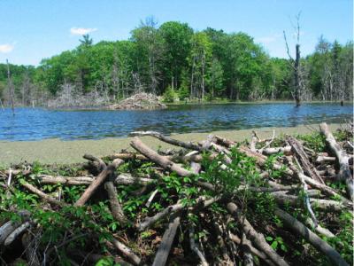
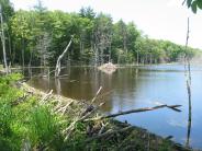
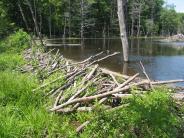
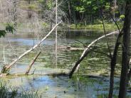
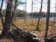
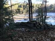
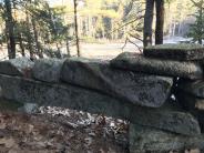
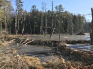
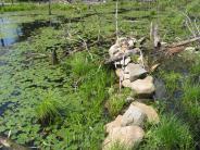
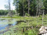
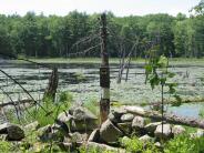
The Longmarsh Preserve consists of four contiguous parcels: the Langmaid Farm (45 acres), Colby Marsh (13 acres), and Horsehide Creek (15 acres). The forested sections of the Durham transfer station property (~40 ac) add to the large area of open space in this region. The Preserve is within a large unfragmented – by roads or development – block of forest, wetlands, and old field habitats. Much of the Preserve is within the Crommet Creek watershed, an ecologically significant and unique drainage that flows into Great Bay. Within the headwaters of this watershed, the Town of Durham owns the northern section of Colby Marsh, a significant wetland with nesting osprey, great blue heron, wood duck and other birds, active beaver, and a host of other wildlife. The Langmaid Farm includes overgrown fields, stone walls, old foundations, bold rock outcrops, and beaver-influenced wetlands. Crommet Creek wends its way through the Preserve as it makes it ways to Great Bay just south of Adam’s Point.
The northern reaches of the Longmarsh Preserve drain north into Horsehide Creek, a small drainage that flows north into the Oyster River. Beaver are active in this creek, as they are in Crommet Creek. An Eversource utility right-of-way line runs through the Preserve, close to the height of land that creates the watershed divide. The Town's Longmarsh Preserve is surrounded by thousands of acres of land conserved by NH Fish and Game, The Nature Conservancy, and the Society for the Protection of NH Forests. Some of these lands are private and many do not have trails; please respect their boundaries.
The 4-mile long Sweet Trail begins at the parking lot on Longmarsh Road just west of Colby Marsh. The trail starts out along the class VI portion of Longmarsh Road, turns south just before the boardwalk, crosses the old stone bridge on the Longmarsh Preserve, meanders generally south into Newmarket, and ends at the shores of Great Bay. Other trails on the Preserve offer great views of marshes, open water, rocky outcrops, mature oak and pine forests, and lots of wildlife.
RECREATIONAL OPPORTUNITIES:
- Hiking and running
- Cross-country skiing and snowshoeing
- Mountain biking (no bikes south on the Sweet Trail)
- Dog-walking (dogs on-leash/under control; pick up dog waste)
- Fishing
- Birdwatching/Nature observation
AMENITIES:
- Parking, Trail network, Informational kiosk, Scenic views
RESTRICTIONS:
- Open dawn to dusk
- No hunting on Town land
- No motorized wheeled vehicles (ATVs, trucks, dirt bikes)
- No horseback riding
- No campfires or camping
- Carry in, Carry out all trash
- Do not disturb plants, animals, historical or cultural features
Click any thumbnail image to view a slideshow

